An atmospheric traffic jam will plunge Ontario into summer next week
Ontario is looking to start June with a solid dose of vivid sunshine and borderline-hot temperatures
If you’re a fan of summer weather, you might want to send a thank-you letter to a ridge of high pressure parking itself over the province for the next week.
The pattern across Ontario looks to repeat itself through the opening days of June, with temperatures eventually cracking the 30-degree mark for many spots by the middle of next week.
DON'T MISS: Clouds are spreading antibiotic-resistant bacteria around the world, study finds
Ontario’s good meteorological fortunes will come at the expense of folks down in the southeastern and Mid-Atlantic states, where days of drenching rain and temperatures 10+ degrees below seasonal will be a common sight heading into the final days of May.

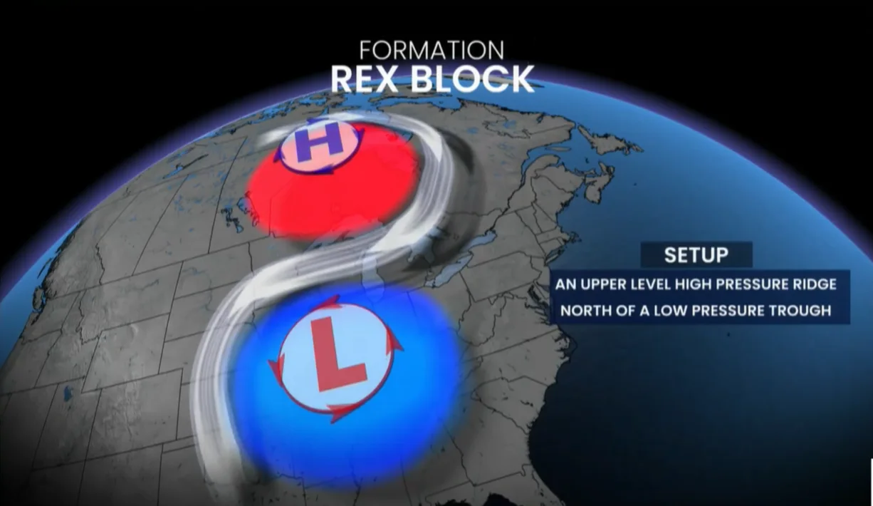
This overall pattern, known as a Rex block, occurs when an upper-level ridge of high pressure locks into place north of an upper-level trough of lower pressure, creating what amounts to an atmospheric traffic jam.
Without any major systems to break up this damming effect and move things along, the Rex block can remain in place for days on end and stagnate conditions for communities caught beneath this pattern.
While that’s a glum kickoff to the summer season for tourist towns along the U.S. East Coast, it’s going to mean sunny skies and a taste of summer’s heat for folks here at home looking for some valuable outdoors time.

As that high pressure aloft locks into place over Ontario, sinking air will dominate the skies across the province, leading to a remarkable stretch of sunshine, minimal rain chances, and temperatures that’ll steadily warm through the first days of June.
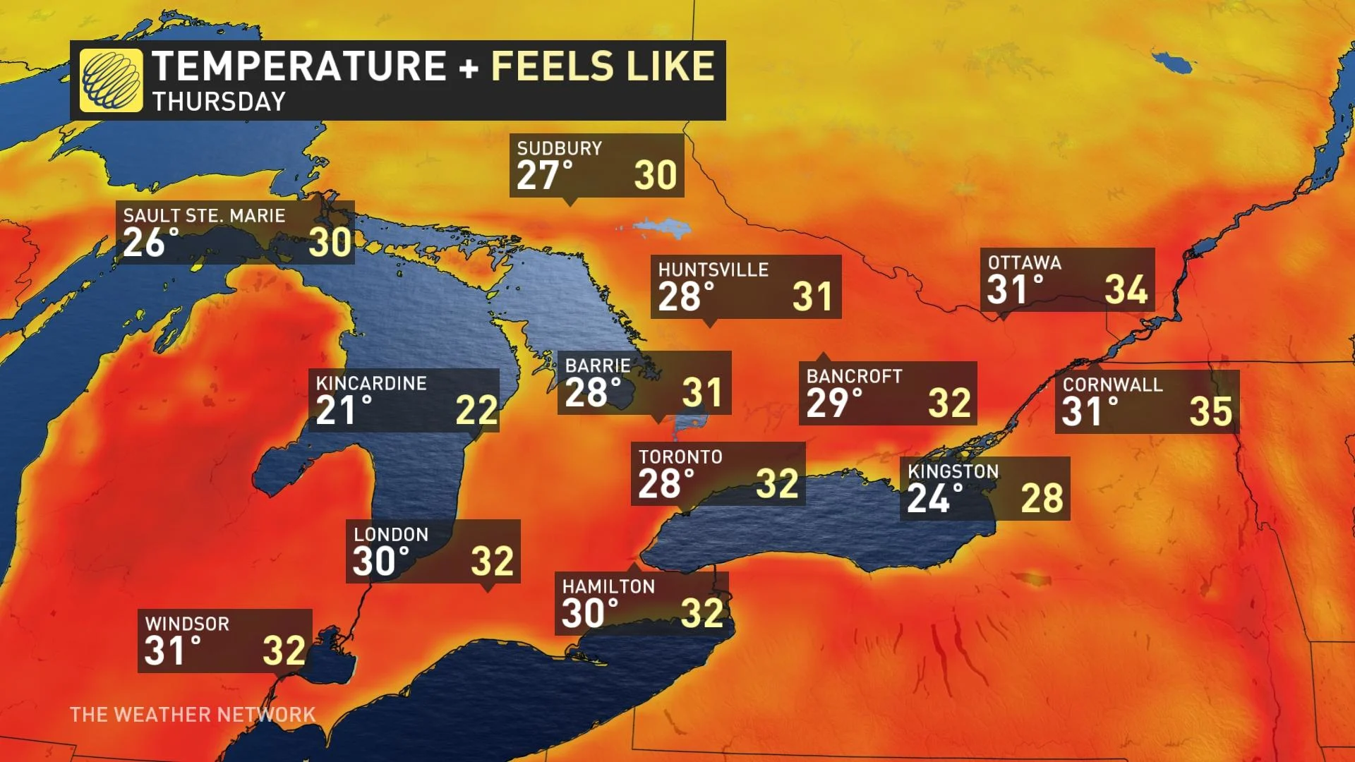
By next Thursday, June 1, forecasters see the potential for highs reaching 30°C or warmer from Windsor to Ottawa, with feels-like values easily climbing into the 30s as far north as Timmins and Chapleau.
While this looks to be a welcome arrival of summertime conditions for much of Ontario, daytime highs creeping into the 30s paired with rising humidity and warmer nights could put stress on vulnerable individuals.
Check on family, friends, and neighbours who may be susceptible to the ill effects of higher temperatures. It’s a good idea for everyone to take it easy in the heat of the day, as those who are healthy and physically fit can still succumb to heat-related illnesses without proper precautions.

MUST SEE: Sunscreen 101: Become a sun protection pro
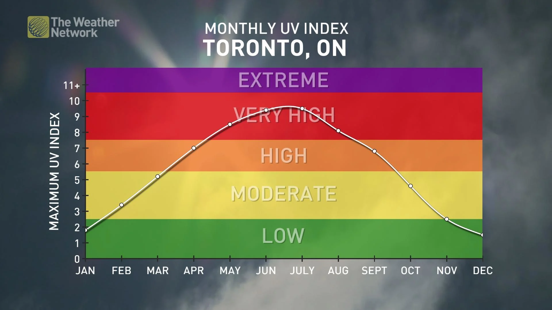
We’re also entering the peak of sunburn season across Ontario. The sun is climbing ever closer to its highest point in the daytime sky, and this is peak-season for the year’s highest UV index.
A very high UV index of 8+ can lead to a painful sunburn in just minutes, which can be easily avoided with sunscreen rated SPF 15 or higher, as well as by wearing a hat and rocking a pair of UVA- and UVB-rated sunglasses that can protect your retinas from painfully scratchy sun damage.
Stay with The Weather Network for the latest forecasts across Ontario.


