After a strong start in April, spring sputters into May across Canada
The first half of May will be dominated by the same pattern that gripped the second half of April, but the focus of the cold weather will shift somewhat.
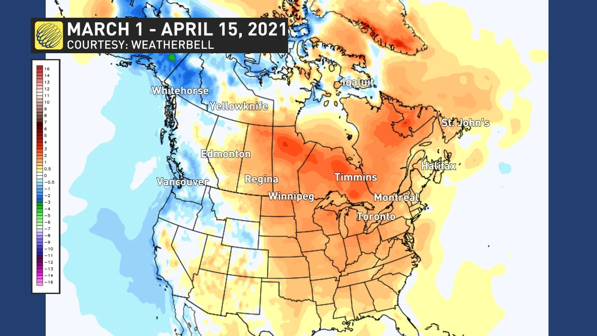
Spring got off to a strong start across most of Canada, with above-seasonal temperatures dominating east of the Rockies from the end of February until the middle of April.
The temperature anomaly map below shows temperatures relative to normal from March 1st to April 15th and the various shades of yellow, orange, and red highlight the widespread warmer than normal temperatures.
However, the warm spring suffered a major setback across Central Canada when a major pattern change occurred during the middle of the month.
The graphic below shows temperatures compared to normal for the final two weeks of April. The widespread shades of blue and green highlight the regions that have been colder than normal.
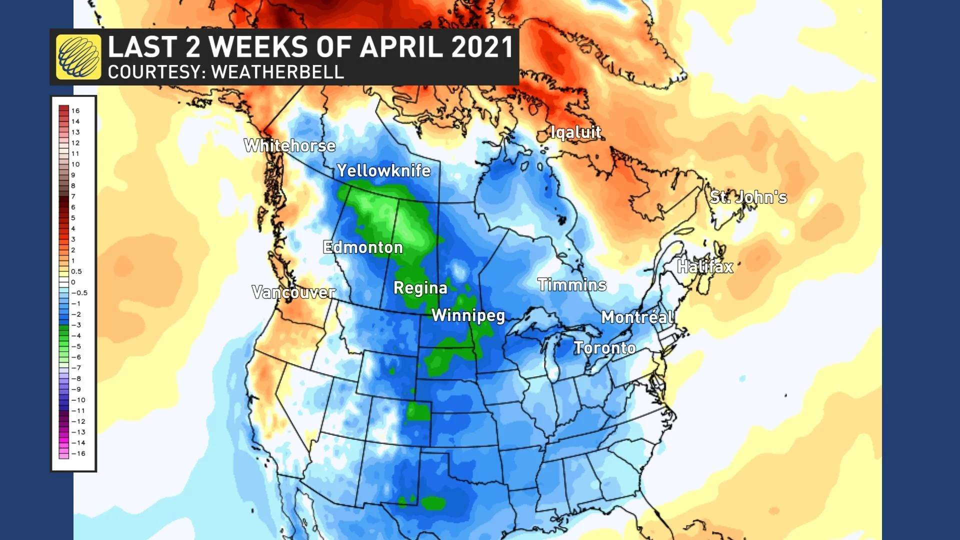
Meanwhile, B.C. and Atlantic Canada have seen back and forth swings in temperatures, which have come close to offsetting each other.
So, which version of the spring pattern can we expect for the month of May?
For the first half of May, we will continue to see the pattern that dominated during the second half of April, but the focus of the cold weather will shift further to the east.
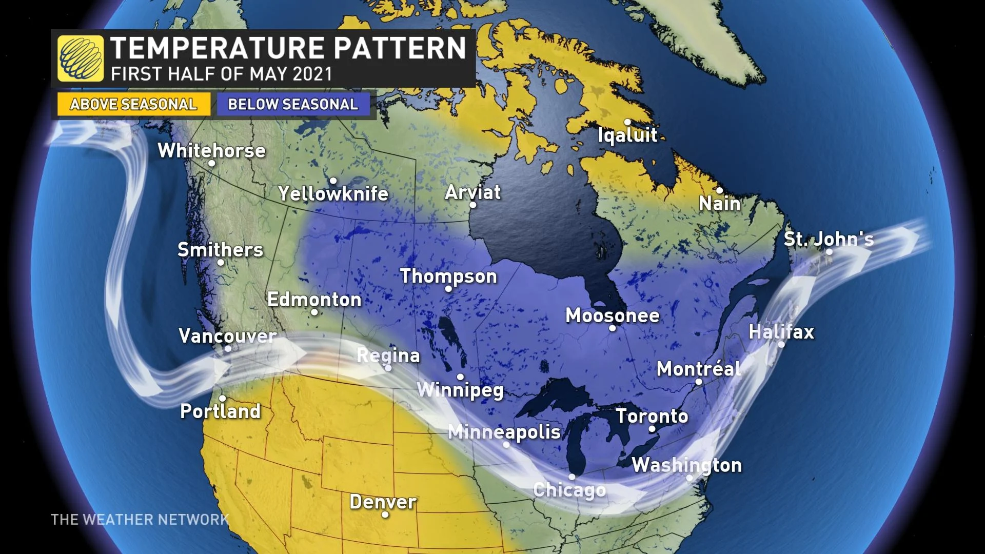
That means a lack of consistent warmth across Canada, and for Ontario and Quebec, temperatures will often be more typical of early to mid-April. Therefore, you should not give in to the temptation to get an early start on your gardening, as this region will continue to have a risk for frost from time to time through mid-May. This is especially a concern for the orchards, which blossomed much earlier than normal and are now very vulnerable to a freeze.
However, the strong blocking pattern in the jet stream responsible for this colder pattern is expected to slowly relax during the middle of May. That should allow for a transition to a warmer and more typical pattern during the second half of the month.
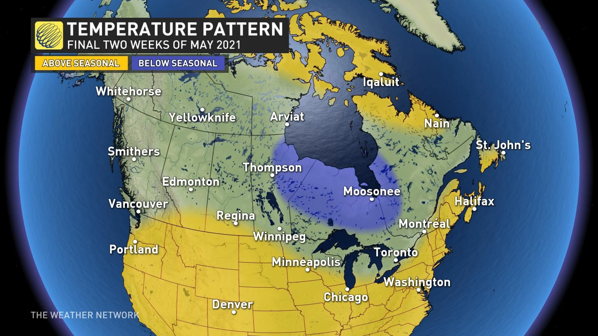
The other story that we'll be closely following during May is the worsening drought conditions across much of the Prairies. The May pattern will be conducive to seeing much-needed rain (and possibly even some snow) across the region, but precipitation totals will not reverse the growing deficits across the region. This is concerning given the expectation that southern areas will see a hot and dry pattern during the summer months.


