Potent Prairies system threatens severe storms, heavy rain
We’re in for an active start to the week across the Prairies with multiple areas under threat for heavy rain and strong thunderstorms
Get ready for another wild week on the Prairies as a slow-moving storm creeps north of the border.
Gusty winds, widespread heavy rainfall, unseasonable warmth, and a risk for severe thunderstorms will accompany this storm as it treks into Canada.
Visit our Complete Guide to Fall 2024 for an in-depth look at the Fall Forecast, tips to plan for it and much more!
This week’s impending storm is going to feel remarkably similar to what we experienced last week. A centre of low pressure developing stateside will cross the border early this week, bringing active weather and a change in temperatures as it arrives.
Be sure to stay alert to the changing conditions and any watches and warnings that are issued in your area.
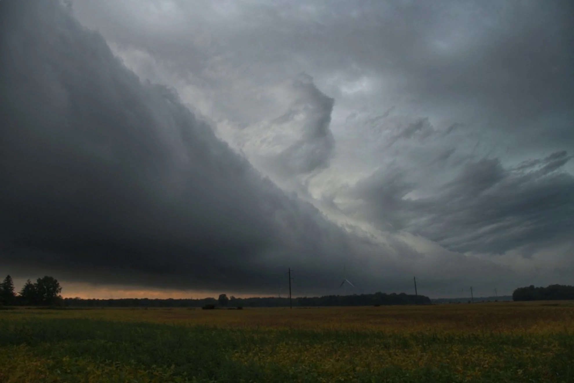
Severe storm risk on Monday
The most pressing threat is a risk for severe weather that’ll develop over portions of the southern Prairies during the day Monday and extend through the overnight hours into Tuesday.

Thunderstorms will initially develop over North Dakota during the day Monday. These storms will push north along a warm front through the afternoon and evening hours, eventually tracking into southern Manitoba and northwestern Ontario. This threat includes the City of Winnipeg.
Torrential rainfall, strong winds, and large hail are possible in the strongest storms that develop. Look out for localized flooding across communities that experience prolonged downpours.
Widespread heavy rain, gusty winds
Farther west, we have to watch the bulk of the low as it meanders over Saskatchewan and Alberta. Several days of widespread heavy rainfall will accompany the storm as it moves into Canada, with the heaviest precipitation targeting areas of eastern Alberta and western Saskatchewan.

Some communities near the provincial border could see up to 100 mm of rain through Thursday as this storm passes through the region.
Rain isn’t the only hazard we’ll see with this system. Gusty northwesterly winds will blow across Alberta and western Saskatchewan for the duration of the storm. Folks can expect gusts up to 80 km/h in parts of Alberta, with gusts of 70 km/h possible in Saskatchewan.
Big temperature spread develops
Summer-like temperatures on the eastern side of the storm will send readings as much as 9°C above seasonal on Monday and Tuesday, especially in Manitoba including Winnipeg and Dauphin.

Meanwhile, cooler air filtering in on the western side of the system will keep temperatures well below seasonal across southern Alberta. Calgary and Lethbridge will struggle to climb into the mid-teens on Wednesday.