Groups use AI to accelerate solutions for conservation, drought areas

The prevalence of drought conditions in parts of Canada this year and other ongoing threats to the environment posed by climate change have inspired many Canadian groups to utilize artificial intelligence as a counteractive tool
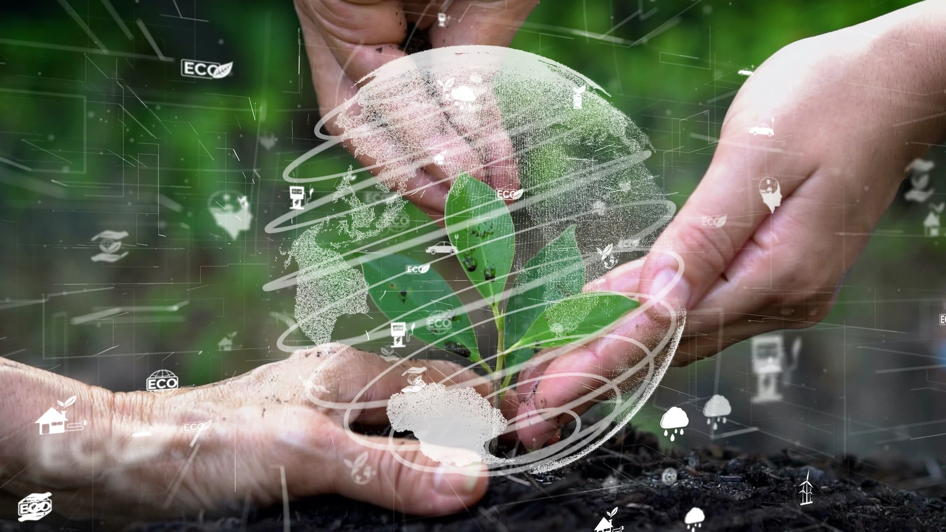
With climate change's ever-growing, negative impacts on Canada, more groups are recruiting artificial intelligence (AI) as a tool to find effective solutions to counter the various threats caused by the increase in extreme weather.
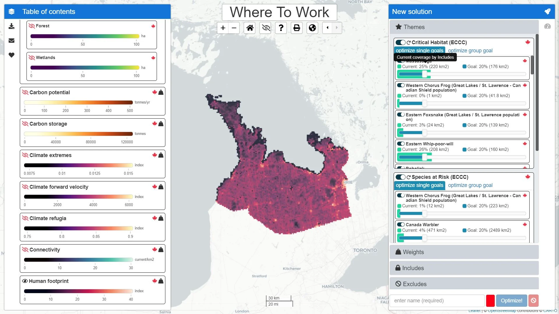
Among the organizations turning to AI for help is the Nature Conservancy of Canada (NCC), which has partnered with Carleton University to establish a new digital tool, Sites. The program uses AI software and prioritization algorithms to streamline the arduous conservation process.
RELATED: What role can AI play in helping vulnerable species and habitats?
To be officially unveiled at the 2024 Global Congress of the International Land Conservation Network (ILCN) convention, co-hosted by NCC and taking place from Oct. 16-18 in Quebec, Sites is an open-access platform that can be used for free by any organization or government agency that works in conservation, including Indigenous communities and non-profit land trusts.
Richard Schuster, NCC's director of spatial planning and innovation, said Sites is "really a decision-support tool that helps us crunch all those, sometimes huge, amounts of data."

Sites screenshot. (Nature Conservancy of Canada/Submitted to The Weather Network)
"A lot of work that we do is trying to find the best available data that works across the country. So, no matter where you are in Canada, as an interested party or interested entity, you can actually use that data to help inform decisions," said Schuster, in a recent interview with The Weather Network.
"That's meant to really help reduce the amount of time it takes to find data out there."
Two sets of tools within Sites
The program includes multiple components. The where to work tool creates spatial analysis using large, numerous and reliable Canadian datasets on various species, climate, soils and hydrology, according to a description on the Sites website.
It also incorporates metrics and mathematical optimization algorithms to reveal prioritization sites based on criteria specially chosen by the users to fulfill their target to protect diversified and ecologically valuable land.

Sites screenshot. (Nature Conservancy of Canada/Submitted to The Weather Network)
"It's really meant to be a lot quicker, but it's also more transparent and easier for people to sit around a table, or a virtual table, [and] come up with the ideas," said Schuster.
The second part of the program, the what to do tool and its complementary application, will assist interpreters with identifying and choosing preferred actions to protect the benefits of nature through conservation activities.
"What are the conservation actions that we want to take that make the most sense and provide the biggest benefit for biodiversity in a certain landscape?" said Schuster.
Sites screenshot. (Nature Conservancy of Canada/Submitted to The Weather Network)
Anyone will be able to use Sites
The biggest benefit to the tools will be the accessibility. Anyone that needs to use them can, without any academic or technical training, Schuster said.
"A big component of what we work on is creating the user interface that's, hopefully, fairly intuitive, so it's easier for folks to actually run those kinds of sophisticated algorithms without needing to learn all the technical underpinnings by themselves," said Schuster.
The "big driving force behind it" is that NCC wants to make Sites as widely available as possible so the government entities it works with, and other interested organizations can also use the tools, he said.
"That is really important to keep in mind. It's not just one entity like NCC. It's different levels of government. It's Indigenous communities, other stakeholders, and then NCC plays a part. But we're doing it collectively, ideally," said Schuster.

(Jason Bantle/Nature Conservancy of Canada)
The NCC director of spatial planning and innovation said the new program will help the organization achieve its land protection goals faster and improve the "way we get there," also noting its goal is to conserve an additional 1 million hectares by 2030.
The Canadian government also previously committed to protecting 30 per cent of the country's terrestrial lands and waters by 2030 in its 30-by-30 initiative.
"It's not just the hectares, but it's also how much benefit [it] provides for [our] species," said Schuster. "That's really in line with our strategic plan and direction on creating resilient landscapes that really benefit biodiversity the most, for as much as we can across Canada."
WATCH: Could AI transform the future of weather forecasting?
AI utilized to find drought-vulnerable areas in Canada
Artificial intelligence isn't just being used for quicker and more efficient land conservation planning policies.
Researchers from the Ottawa and Laval universities have introduced an advanced AI-based method to map drought-prone regions countrywide. A recent study by the aforementioned universities indicates climate change may cause many areas in Canada to endure significant droughts by the end of the century.

(Nathan Coleman/The Weather Network)
“Drought is a significant threat to Canada, impacting agriculture, water resources and ecosystems,” said Hossein Bonakdari, associate professor at University of Ottawa and lead researcher on the project, in the news release. “Our research provides a detailed analysis of historical drought patterns and projections for future drought trends, allowing for more informed decision-making in climate resilience planning.”
According to the University of Ottawa, the study uses deep-learning techniques and integrates data from the Canadian Drought Monitor (CDM) and ERA5-Land to examine past drought patterns and to project future trends up to 2100.
“This innovative approach fills data gaps and enables robust projections under different climate change scenarios outlined by the sixth Intergovernmental Panel on Climate Change (IPCC) report," said Bonakdari.
He also said the ability to accurately forecast drought areas in Canada using AI is a "significant advancement in climate resilience planning.”
WATCH: How artificial intelligence could change the way we fight wildfires
Thumbnail courtesy of Getty Images-1302537648.
Follow Nathan Howes on X, formerly known as Twitter.